Alex Chen's Research Projects
Home CV Research Teaching Personal


Mucosal Immunity

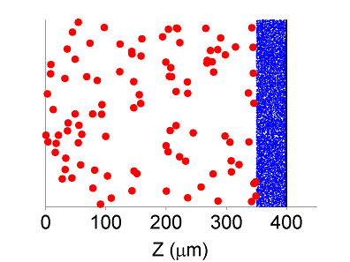
Mucus coats all exposed organs such as the airways, intensines, and the female reproductive tracts, and these secretions play an essential role in our defense against foreign pathogens by acting as a buffer zone between invading pathogens and the underlying tissues. Its protective role, however, has often received relatively little attention, however, because of the poor understanding of how quickly pathogens cross mucus secretions. Our research group has introduced a model to quantify the degree of protection which can be provided by antibodies, which bind to viruses within the mucus layer, before the viruses can reach vulnerable tissue.

Publications:

S. McKinley, A. Chen, F. Shi, S. Wang, P. Mucha, M.G. Forest, S. Lai (2014). Modeling neutralization kinetics of HIV-1 by broadly neutralizing monoclonal antibodies in genital secretions coating the cervicovaginal mucosa. PLoS one, 9(6), e100598.

A. Chen, S. McKinley, S. Wang, F. Shi, P. Mucha, M.G. Forest, S. Lai (2014). Transient antibody-mucin interactions produce a dynamic molecular shield against viral invasion. Biophysical Journal 106(9), 2028--2036.

A. Chen, S. McKinley, S. Wang, F. Shi, P. Mucha, M.G. Forest, S. Lai. Lack of virion collision in mucus limits role of sIgA-mediated immune exclusion at mucosal surfaces. Submitted to Biophysical Journal.

MATLAB GUI of Model from PLoS one paper: MATLAB GUI

Movie of virus motion simulation in the female reproductive tract:

Landscape Evolution

The evolution of a landscape is affected by many different factors such as grade of slope, surrounding vegetation, wind, soil quality, etc. Previous geological models have often added many parameters in order to measure the morphology of a landscape as accurately as possible. These laws can be quite accurate for processes near steady state, but they cannot track evolution on a longer time scale. We seek to reduce the number of parameters in order to examine qualitatively the formation of common features observed in nature. The model consists of a coupled system of three PDE based on the most important factors from previous landscape evolution models as well as conservation laws. Using these conservation laws allows for operation under longer time scales. Evaluation of the model is based on whether the formation of features such as rivers, canyons and lakes is observed and plausible.

Publications:

A. Chen, J. Darbon, G. Buttazzo, F. Santambrogio, J.-M. Morel (2014). On the equations of landscape formation. Interfaces and Free Boundaries 16, 105--136.

A. Chen, J. Darbon, J.-M. Morel (2014). Landscape evolution models: a review of their fundamental equations. Geomorphology, 219, 68--86.

A. Chen, J. Darbon, C. de Franchis, G. Facciolo, E. Meinhardt, J. Michel, J.-M. Morel. Numerical simulation of landscape evolution and water run-off on digital elevation models obtained from Pleiades. Submitted to Revue Francaise de Photogrammetrie.

Movies of our landscape evolution model on the islands of La Reunion and Madeira:

Boundary Tracking

Boundary tracking is an algorithm to track the boundaries of an object of interest, closely related to the problem of image segmentation (see below). The idea is to visit only points near the boundary in question, resulting in substantial savings in computation time. As such, boundary tracking works well for large data sets. Boundary tracking algorithms are also ideally suited for irregularly shaped boundaries, i.e. fractal. The boundaries of coastlines can be tracked with a high degree of accuracy, and important characteristics such as fractal dimension can be estimated efficiently. Another application is for the segmentation of corners, often problematic for many methods requiring a length-minimization boundary term.

Publications:

A. Chen, T. Wittman, A. Tartakovsky, and A. Bertozzi. Image segmentation through efficient boundary sampling (2009). pdf

A. Chen, T. Wittman, A. Tartakovsky, and A. Bertozzi (2011). Efficient Boundary Tracking Through Sampling. Applied Mathematics Research eXpress, 2011(2), 182--214. pdf

A. Chen. Improved Boundary Tracking by Off-Boundary Detection (2012). Proceedings of SPIE Remote Sensing. pdf


Atomic Force Microscopy

Atomic force microscopy (AFM) is a method of imaging using a needle-cantilever system that relies on force instead of light in order to image at very high spatial resolution. Unfortunately, the needle must move slowly across the imaging domain. Traditionally, AFM images have been gathered using a raster scan. Our research group (in collaboration with Paul Ashby of Lawrence Berkeley National Laboratory) is working on using boundary tracking as a method to avoid raster scans while still following features of interest. Image inpainting is also adapted to reconstruct information at those points that the algorithm does not visit. Other problems such as thermal drift and sample tilt are also considered, leading to a more complicated problem than for usual images.

Publications:

A. Chen, A. L. Bertozzi, P. D. Ashby, P. Getreuer, and Y. Lou (2013). Enhancement and Recovery in Atomic Force Microscopy Images. Excursions in Harmonic Analysis, Volume 2, Andrews, T.D.; Balan, R.; Benedetto, J.J.; Czaja, W.; Okoudjou, K.A. (Eds.), Birkhauser Basel, 311-332. pdf

T. Meyer, D. Ziegler, C. Brune, A. Chen, R. Farnham, N. Huynh, J.-M. Chang, A. Bertozzi, P. Ashby (2014). Height drift correction in non-raster atomic force microscopy. Ultramicroscopy 137, 48-54. pdf

Image Segmentation

Computer vision is in general a difficult problem. Humans have a lifetime of experiences to draw upon in order to determine the content of an image. It is relatively more difficult to program an approximation of such experiences into a computer. The problem of image segmentation, that of partitioning an image into constituent parts, has been studied from a wide variety of approaches, from statistical methods to PDE energy methods. With large data sets, the problem can require a great deal of computation power. One new approach is to use a hybrid method to obtain a rough estimate for boundary locations and then to use the boundary tracking method outlined above on the full data.

Publication:

A. Chen. Active Contours with Edges: Combining Hyperspectral and Grayscale Segmentation (2012). Proceedings of SPIE Remote Sensing. pdf

Hyperspectral Imaging


The use of airborne imagery has many practical applications, including geological surveys, bathymetry and coastline studies, and the military. In particular, hyperspectral imagery is a generalization of color to a large dimensional space typically (30~250) reaching from the ultraviolet range into the infrared spectrum. As such, hyperspectral images contain much more information than standard color images. One of the most important issues involved is processing such a large amount of data: how can the data size be reduced in such a way so that the data can be studied easily while preserving most of the important information? In addition, hyperspectral imaging obtains detailed spectral information at the expense of spatial resolution. Thus, one would like to use the high spectral resolution without being handicapped by the low spatial resolution and to reconstruct the hyperspectral data at high resolution, if possible.

Publication:

A. Chen. The Inpainting of Hyperspectral Images: A Survey and Adaptation to Hyperspectral Data (2012). Proceedings of SPIE Remote Sensing. pdf